Project
Community
News
My App
My maps
Maps of Municipality of Poljčane
Advanced search
All
Private
Favorites
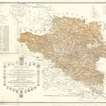
Neueste special Karte des Cillier Kreises im Herzogthume Steyermark
1836|Jos. Fr. Kaiser
1:220 000
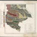
Geologische Uebersichtskarte des Herzogthumes Steiermark
1865|Schneider, Theodor
1:295 000
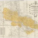
Spezial Karte des Marburger Kreises im Herzogthum Steyermark
1841|Jos. Fr. Kaiser
1:220 000
Neueste special Karte des Cillier Kreises im Herzogthume Steyermark
1840|Jos. Fr. Kaiser
1:210 000
Special Karte des Marburger Kreises im Herzogthume Steyermark
1836|Jos. Fr. Kaiser
1:200 000
Routen von und nach dem Badeorte Töplitz
1870|C. Albrecht
Spezial Karte des Marburger Kreises im Herzogthum Steyermark
1836|Jos. Fr. Kaiser
1:220 000
1600
1650
1700
1750
1800
1850
1900
1950
2000
History
Old maps of Municipality of Poljčane
Discover the past of Municipality of Poljčane on historical maps
Old maps of Municipality of Poljčane
Discover the past of Municipality of Poljčane on historical maps
Explore Maps
Discover History
Parent places
Slovenia
Related places
© MapTiler
© OpenStreetMap
 1836|Jos. Fr. Kaiser1:220 000
 1865|Schneider, Theodor1:295 000
 1841|Jos. Fr. Kaiser1:220 000
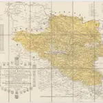 1840|Jos. Fr. Kaiser1:210 000
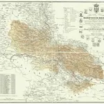 1836|Jos. Fr. Kaiser1:200 000
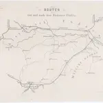 1870|C. Albrecht
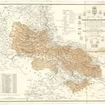 1836|Jos. Fr. Kaiser1:220 000