Project
Community
News
My App
My maps
Maps of Stralsund
Advanced search
All
Private
Favorites
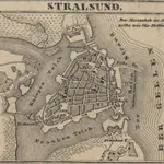
[Stralsund]
1858
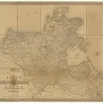
Karte von Neu-Vorpommern und der Insel Rügen
1847|Hagenow, Fr. von
1:200 000
Stralsund
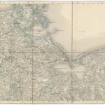
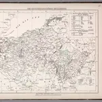
1875|Militärgeographisches Institut
1:300 000
Charte von dem Gross-Herzogthümern Mecklenburg-Schwerin, und Mecklenburg-Strelitz
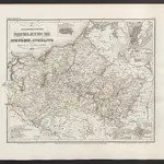
1825|Streit, Friedrich Wilhelm
1:359 000
V.2:6-10:IX. Preussen. II. Prov: Pommern. Reg: Bez: 1. Stettin
1825|Hermann, O.
1:200 000
[Die Grossherzogthümer Mechlenburg Schwerin und Strelitz]
1860|Meyer, J.
Die Grossherzogthuemer Mecklenburg.
1847|Flemming, Carl
1:559 000
1600
1650
1700
1750
1800
1850
1900
1950
2000
History
Old maps of Stralsund
Discover the past of Stralsund on historical maps
Old maps of Stralsund
Discover the past of Stralsund on historical maps
Explore Maps
Discover History
Parent places
Mecklenburg-Vorpommern
Related places
© MapTiler
© OpenStreetMap
 1858
1858
 1847|Hagenow, Fr. von1:200 000
 1875|Militärgeographisches Institut1:300 000
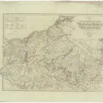 1825|Streit, Friedrich Wilhelm1:359 000
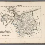 1825|Hermann, O.1:200 000
 1860|Meyer, J.
 1847|Flemming, Carl1:559 000