Progetto
Comunità
Notizie
La mia app
Le mie mappe
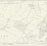
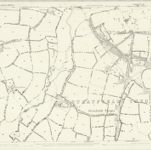
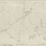
Berkshire XLV.14 (includes: Beech Hill; Heckfield; Stratfield Saye; Stratfield Turgis; Stratford Mortimer) - 25 Inch Map
1909
Ordnance Survey
1:3k
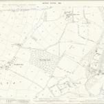
Berkshire XLV.14 (includes: Beech Hill; Heckfield; Stratfield Saye; Stratfield Turgis; Stratford Mortimer) - 25 Inch Map
1898
Ordnance Survey
1:3k
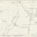
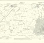
Hampshire and Isle of Wight XI.2 (includes: Hartley Wespall; Heckfield; Stratfield Saye; Stratfield Turgis) - 25 Inch Map
1909
Ordnance Survey
1:3k
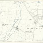
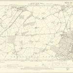
Hampshire and Isle of Wight XI.2 (includes: Hartley Wespall; Heckfield; Stratfield Saye; Stratfield Turgis) - 25 Inch Map
1894
Ordnance Survey
1:3k
Hampshire and Isle of Wight XI.2 (includes: Hartley Wespall; Heckfield; Stratfield Saye; Stratfield Turgis) - 25 Inch Map
1872
Ordnance Survey
1:3k
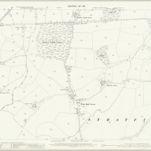
Berkshire XLV.SW - OS Six-Inch Map
1909
Ordnance Survey
1:11k
Berkshire XLV.SW - OS Six-Inch Map
1898
Ordnance Survey
1:11k
Hampshire & Isle of Wight V.SW - OS Six-Inch Map
1894
Ordnance Survey
1:11k
Berkshire XLV.13 (includes: Bramley; Mortimer West End; Silchester; Stratfield Saye; Stratford Mortimer) - 25 Inch Map
1909
Ordnance Survey
1:3k
Hampshire and Isle of Wight XI.1 (includes: Bramley; Silchester; Stratfield Saye) - 25 Inch Map
1909
Ordnance Survey
1:3k
La storia
Vecchie mappe di Stratfield Saye
Scoprite il passato di Stratfield Saye sulle mappe storiche
Vecchie mappe di Stratfield Saye
Scoprite il passato di Stratfield Saye sulle mappe storiche
Esplorare le mappe
Scoprire la storia
Regione madre
Basingstoke and Deane
Luoghi correlati